
The NASA-NOAA Suomi NPP satellite provided two nighttime views of Hurricane Delta as it moved toward the U.S. Gulf Coast.
A moonlit image and an infrared image revealed the extent and organization of the intensifying hurricane.
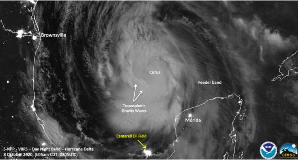
On Oct. 8 at 4:05 a.m. EDT (0805 UTC), the Visible Infrared Imaging Radiometer Suite (VIIRS) instrument aboard NASA-NOAA’s Suomi NPP satellite captured an infrared and nighttime imagery of Hurricane Delta as it moved through the Gulf of Mexico.
One hour before Suomi NPP passed overhead, Delta had winds of 100 mph, making it a Category 2 storm on the Saffir-Simpson Hurricane Wind Scale. “The imagery showed enhanced convection near the center of circulation, though the actual circulation was covered by a central dense overcast (CDO) feature, but the curved bands beyond that, extending all the way to the U.S., can also be seen,” noted William Straka III, researcher at University of Wisconsin – Madison’s Space Science and Engineering Center, Cooperative Institute for Meteorological Satellite Studies, Wisconsin.
Continue reading at NASA Goddard Space Flight Center
Image via NASA Goddard Space Flight Center


