
Models based in part on a method NASA has used to track and count wild salmon in Nevada can now be used by governments and humanitarian organizations to more accurately estimate populations and allocate aid to remote regions of the world.
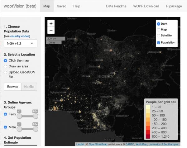
In hard-to-reach areas where terrain, conflict and expense can make such counts difficult and even unsafe, the models use Earth observation data of buildings, land cover and other human “signatures” to estimate remote populations. The Nigerian government is using the technique to allocate polio vaccinations in places where doing a simple census is difficult.
"For a vaccination campaign, organizers may need to know how many children under 5 live in a village that needs polio vaccinations," explained project leader Doug Leasure, a senior enterprise fellow in the WorldPop Group at the University of Southampton in the United Kingdom. "But simply counting the kids just isn't always an option."
Previously, Leasure led a NASA Earth Science Division Applied Sciences project on salmon populations. He realized that the data used to model fish populations – aerial imagery, satellite data and environmental factors – were transferrable to estimating human populations. Leasure and his team recently published a report in the Proceedings of the National Academy of Sciences on how they adapted fish census techniques to track human activities.
Continue reading at NASA Earth Science Division
Image via NASA Earth Science Division


