
Sandy shorelines in hurricane’s path were already altered by Laura.
Sandy shorelines in hurricane’s path were already altered by Laura.
To learn more about USGS’s role in providing science to decision makers before, during and after Hurricane Delta, visit www.usgs.gov/delta
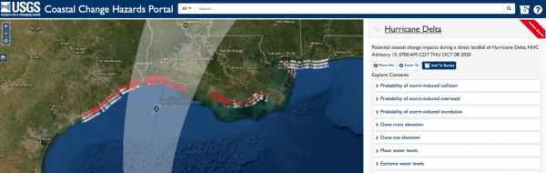
A U.S. Geological Survey coastal change forecast predicts that 52% of Louisiana’s barrier islands and beaches will be inundated - continuously submerged with flooding behind the dunes - by the storm surge from Hurricane Delta. The storm is likely to cause some beach and dune erosion across a wide swath of the central Gulf Coast, with storm waves likely to erode the bases of ocean-facing sand dunes along about 48% of the region’s sandy shorelines.
Scientists and emergency managers can use USGS’s forecasts - produced before major hurricanes and other powerful storms - to plan evacuations, position clean-up equipment to have it ready after the storm. The USGS predicts the storm surge and wave effects will be felt from East Texas through Mississippi, although Delta is not currently predicted to cause erosion of Alabama beaches and barrier islands.
Continue reading at USGS.
Image via USGS.


