
New study results show that ocean heat waves can provide enough fuel for hurricanes to gain momentum as they approach land.
Although most hurricanes tend to weaken as they approach land, some rapidly increase in strength just prior to landfall – a phenomenon that is both dangerous and hard to forecast. As the climate continues to warm, the number of storms that fall into the latter category is likely to increase, presenting a stark reality for communities in their paths. Because current weather models can't accurately predict this sudden intensification, communities preparing for a lesser storm often don't have time to respond to the arrival of a much stronger one or to the magnitude of destruction it is likely to leave behind.
The good news? The results of a new study published in September in Nature Communications identify pre-storm conditions that can contribute to this rapid intensification – an important step in improving our ability to forecast it.
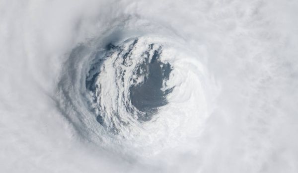
"We analyzed the events that led up to Hurricane Michael in 2018 and found that the storm was preceded by a marine heat wave, an area of the coastal ocean water that had become abnormally warm," said Severine Fournier, a NASA Jet Propulsion Laboratory scientist and a co-author of the study. "Marine heat waves like this one can form in areas that have experienced back-to-back severe weather events in a short period of time."
Continue reading at NASA Jet Propulsion Laboratory
Image via NASA Jet Propulsion Laboratory


