
Farms in the historic Oltenia province display a compelling array of shapes and sizes.
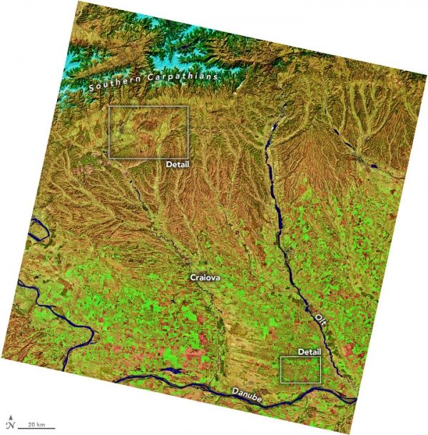
Romania’s landscape has seen plenty of transition in recent decades, as farmers have responded to changes in land management policies and in the natural environment. As a result, many farms display a compelling array of shapes and sizes when viewed from above.
On April 8, 2020, the Operational Land Imager (OLI) on Landsat 8 acquired these images of southwest Romania’s historic Oltenia province. The images are false color (bands 6-5-2) to better distinguish the types of land cover amid the region’s mountains, foothills, and plains.
The top image shows a wide view of the province, bordered to the east by the Olt River, to the south by the Danube River, and to the north by the South Carpathian Mountains. Snow and ice (light blue) cap the range’s higher elevations, which reach up to more than 2500 meters (8200 feet) high. Forested areas of the Carpathians—with ample conifers and deciduous trees—appear dark green and orange.
Continue reading at NASA Earth Observatory
Image via NASA Earth Observatory


