
Raised beaches around the bay in Canada’s Ontario Province show how the landscape responded after the last ice age.
Ice lingered on Hudson Bay as recently as July 2020 and will start to freeze up again in autumn when snowfall and chilly breezes return. In the meantime, this image captures the unique beauty of the region in late summer.
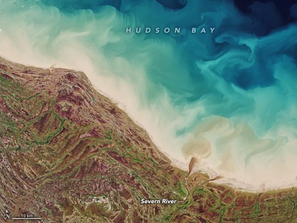
Located in northeastern Canada, just south of the Arctic Circle, Hudson Bay is the world’s second-largest bay and spans 1,230,000 square kilometers (470,000 square miles). This image, acquired on September 19, 2020, with the Operational Land Imager (OLI) on Landsat 8, shows the bay’s southern side where it is bordered by Ontario Province.
The saltwater bay receives fresh water from more than 40 major rivers that flow through various ecosystems and zones of permafrost. The rivers carry sediment and dissolved organic matter, which colors the water brown. In this image, a small dark brown plume is visible at the mouth of the Niskibi River, while a more prominent plume from the Severn River flows around Partridge Island. There is also ample sediment from the seafloor that has become suspended in the water.
Continue reading at NASA Earth Observatory
Image via NASA Earth Observatory


