
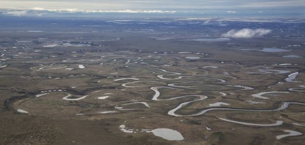
The roughly 23-million-acre National Petroleum Reserve in Alaska is rich in oil and gas resources – and rich in native fish populations.
NASA scientists are combining data from water samples containing fish DNA with satellite data to find native fish and identify their habitats. This information on where native fish are located can be used to protect them and to conserve an important ecosystem in the face of human development and changing climate.
"The innovative methods in this project can determine the presence of fish species over a wide area, more efficiently than previous sampling methods,” said Jay Skiles of the Ecological Forecasting program area within NASA’s Applied Sciences Program, part of the Earth Science Division. He added that this technique of combining remotely sensed satellite data with molecular biology is a new way of measuring biodiversity.
The team constructed customized maps of the predicted locations of multiple fish species for the Bureau of Land Management to use in its decision-making process. This federal agency is in charge of managing lands for multiple uses in the National Petroleum Reserve in Alaska – including oil and gas supplies, recreation, scientific research and subsistence harvests – all while conserving fish and wildlife habitats.
Continue reading at NASA Earth Science Division
Image via NASA Earth Science Division


