
A team of NASA researchers used satellite and radar imagery to help officials in Iowa better understand the effects of a derecho that ripped through the state in August.
An intense August storm gave many Iowans a brief sense of what it might feel like to experience the strong winds of a hurricane.
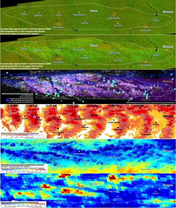
The powerful, fast-moving, line of thunderstorms known as a derecho, blasted across Iowa Aug. 10 with extreme winds. The derecho did catastrophic damage to corn and soybean crops, caused widespread utility and property damage, and resulted in fatalities. NOAA estimates damage totals to be $7.5 billion, making it one of the most costly severe thunderstorm events in U.S. history.
To help officials in Iowa better understand the scale and scope of the disaster, a team of NASA researchers, led by Kris Bedka, a severe storm expert at NASA's Langley Research Center in Hampton, Virginia, and colleagues at NASA's Marshall Space Flight Center in Huntsville, Alabama and the University of Oklahoma, analyzed the storm using data and imagery from multiple Earth-observing satellites and weather radars on the ground.
Continue reading at NASA Langley Research Center
Image via NASA Langley Research Center


