
Nature’s beauty overtook science for an evening.
James Lea spends a lot of time looking at satellite imagery, particularly of cold places. In recent years, the glaciologist from the University of Liverpool has been examining images of the Greenland ice sheet and its edges, cataloging melt ponds—when they form, how large they grow, when they drain. It is painstaking but important work, and Lea and colleague Stephen Brough often turn to computers to sort through the volume of images.
But sometimes the human eye overcomes the artificial one. In October 2020, Lea found a gem while looking through some older imagery. “Doing a lot of tedious manual checking currently, but definitely helps when you come across absolute stunners of images like this one,” he tweeted to colleagues.
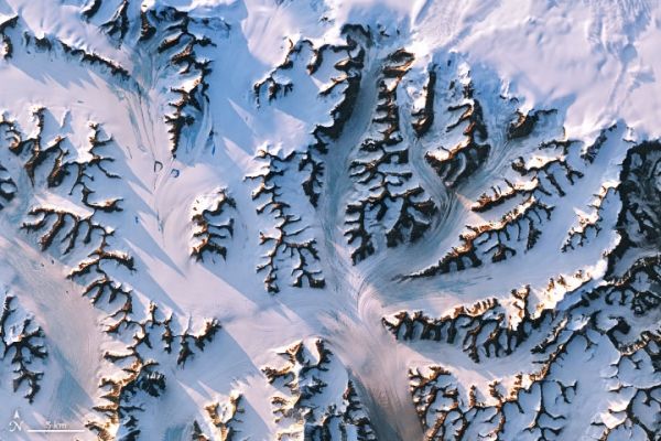
On July 30, 2019, the Operational Land Imager (OLI) on Landsat 8 acquired a natural-color image (top) of glaciers and mountains in eastern Greenland, just inland from the coast. Mountain peaks cast long shadows in the early evening sunlight. In the second image, the natural-color Landsat 8 data was draped over a global digital elevation model to capture the topography of the area.
Continue reading at NASA Earth Observatory
Image via NASA Earth Observatory


