
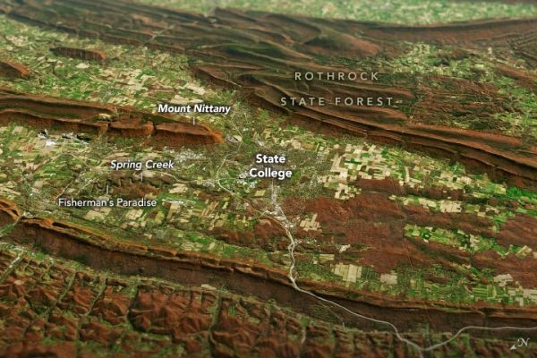
The region of rolling hills and valleys is part of a geologic formation known as the Ridge and Valley Province that stretches from New York to Alabama.
Along with the plentiful harvest of crops in North America, one of the gifts of autumn is the gorgeous palette of colors created by the chemical transition and fall of leaves from deciduous trees. It is an aesthetic wonder from the ground, from the mountaintop, and from satellites.
The folded mountains of central Pennsylvania were past peak leaf-peeping but still colorful when the Operational Land Imager (OLI) on the Landsat 8 satellite passed over on November 9, 2020. The natural-color images above show the hilly region around State College, Pennsylvania; the one below shows the same scene overlaid on a digital elevation model to highlight the topography of the area.
The region of rolling hills and valleys is part of a geologic formation known as the Valley and Ridge Province that stretches from New York to Alabama. These prominent folds of rock were mostly raised up during several plate tectonic collisions and mountain-building episodes in the Ordovician Period and later in the creation of Pangea—when what is now North America was connected with Africa in a supercontinent.
Continue reading at NASA Earth Observatory
Image via NASA Earth Observatory


