
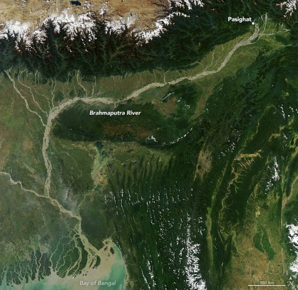
The river’s high sediment load contributes to the abrupt change in its shape as it exits the Himalayas and hits flatter land.
The Brahmaputra is a river of many names. In its upper courses, where it winds through a maze of narrow gorges in Tibet, it is the Yarlung Tsangpo. After a hairpin turn near Namche Barwa, it becomes the Siang. As it cascades through the Himalayan foothills in the northeastern Indian state of Arundal Pradesh, it is called the Dihang. People start calling it the Brahamputra as it widens and flows through Assam. After crossing into Bangladesh and absorbing the flow of several tributaries, it becomes the Jamuna River, then the Padma, and finally the Meghna before pouring into the Bay of Bengal.
The Moderate Resolution Imaging Spectroradiometer (MODIS) on NASA’s Aqua satellite captured this natural-color image of the river on November 9, 2020. Notice how the narrow channel widens after passing the town of Pasighat, transforming into a braided river with multiple, interlacing channels. As the water slows in the flatter Brahmaputra Valley, it loses its capacity to carry sediment, depositing the excess silt in sandbars. In the course of a few kilometers, the river channel increases its width twentyfold.
Continue reading at NASA Earth Observatory
Image via NASA Earth Observatory


