
Sea ice and waterways along the north side of Canada’s high-Arctic island reveal compelling patterns when viewed from above.
At the very top of North America, more than 36,000 islands large and small mingle with the icy waters of the Arctic Ocean. Collectively they comprise the Canadian Arctic Archipelago, and the region’s landscapes and waterscapes are stunningly beautiful. They are also quite remote, making satellite images a good way to explore the region.
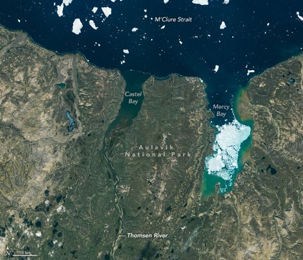
The northern side of Banks Island—the archipelago’s westernmost island—is visible in this image acquired on a rare cloud-free day in July 2015. Centered in the lower half of the image is Thomsen River, a remote destination within the Aulavik National Park that is well-known among canoeing enthusiasts. Visitors to the park—about a dozen in a typical year—are surrounded by Arctic tundra inhabited by muskox, snowy owls, and snow geese.
Although summer was in full swing when the Operational Land Imager (OLI) on Landsat 8 acquired this image, bits of seasonal sea ice persisted offshore and within Mercy Bay. “Particularly obvious is the ‘pearl necklace’ of small ice floes worn by the coast,” said Robie Macdonald, a scientist at the University of Manitoba and the Canadian Department of Fisheries and Oceans.
Continue reading at NASA Earth Observatory
Image via NASA Earth Observatory


