
The state’s brutal fire season has not ended.
Fire season in California generally peaks from May through October. But as global temperatures have risen, so too has the state’s risk for fall season fires.
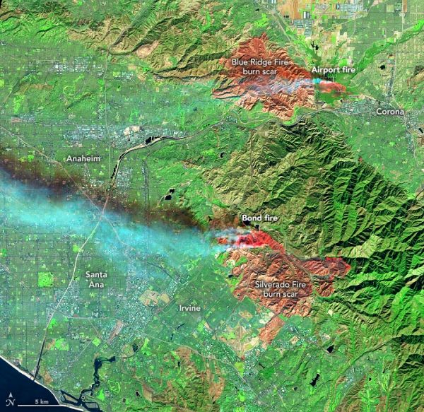
These images show late-autumn fires burning southeast of Los Angeles, alongside the scars of fires from earlier this year. Both images were acquired on December 3, 2020, with the Operational Land Imager (OLI) on the Landsat 8 satellite. The Airport fire ignited on December 1 near an airport and the city of Corona. By December 3, the fire had burned 750 acres and was 10 percent contained.
A second, more widespread fire in the Silverado Canyon area of Orange County ignited on December 2, 2020. Orange County Fire Authority officials estimated that the Bond fire had burned 7,200 acres as of December 3. That number was revised the next day to 6,400 acres as smoke- and fire-mapping technology allowed fire managers to make a more accurate assessment. Evacuation orders were lifted in some areas on December 4, but remained in effect for about 20,000 people.
Continue reading at NASA Earth Observatory
Image via NASA Earth Observatory


