
An international team of scientists has used artificial intelligence and commercial satellites to identify an unexpectedly large number of trees spread across arid and semi-arid areas.
Trees play a vital role in Earth’s carbon and water cycles. They also contribute food, firewood, and other resources important to human activity. But while forests are easy to spot from above, smaller stands of trees have often gone undercounted because they have been harder to detect with the satellite imagers usually available to scientists.
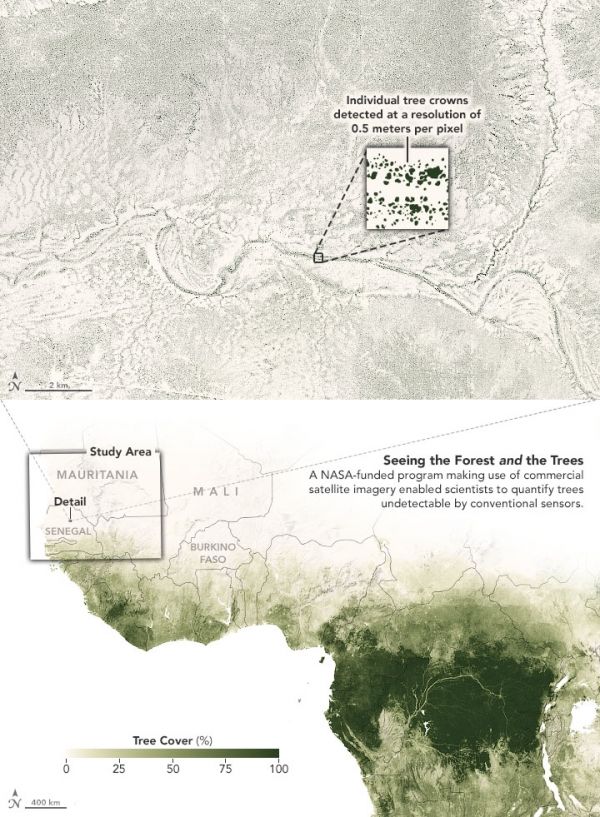
Now an international team of scientists has used artificial intelligence and commercial satellites to identify an unexpectedly large number of trees spread across arid and semi-arid areas of western Africa. These drylands were previously classified as having little to no tree cover, but new analysis techniques proved otherwise. The findings could help scientists better understand and quantify the role drylands have in the storage and cycling of carbon.
The research team used the Blue Waters supercomputer at the University of Illinois and an artificial intelligence technique called “deep learning” to map the trees.
Continue reading at NASA Earth Observatory
Image via NASA Earth Observatory


