
Satellite data indicate that snow is melting earlier, changing when and how much the lake is refilled.
With winter in full swing, the Wasatch and Uinta mountains in the Southern Rockies are still building their snowpack. Come springtime, snowmelt will be flowing downstream, delivering important water resources to lakes, reservoirs, and people. The question is: when does all this melting begin?
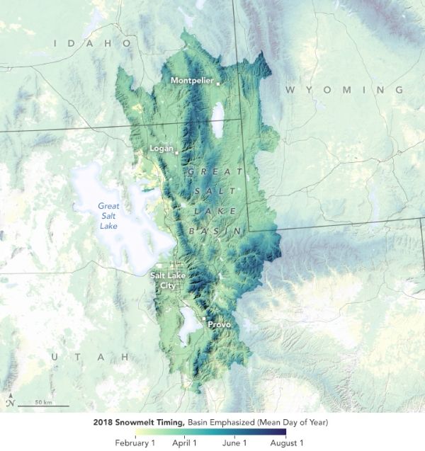
The map above shows the timing of snowmelt within the Great Salt Lake basin in spring 2018, after a particularly bleak year for the region’s snowpack. The basin spans parts of Utah, Idaho, and Wyoming, but only the basin’s eastern side (highlighted above) contributes water to the Great Salt Lake. Areas west of the lake are desert.
The map uses data derived from the Moderate Resolution Imaging Spectroradiometer (MODIS) on NASA’s Terra satellite to indicate the day of the year that each pixel transitioned from snow-covered to snow-free. Melting tends to start at warmer, lower elevations in February (yellow). It follows on for the next several months (darker greens and blues) at ever higher elevations.
Continue reading at NASA Earth Observatory
Image via NASA Earth Observatory


