
Seasonal crop fires are a staple of the sugar harvest, but the smoke might have health effects.
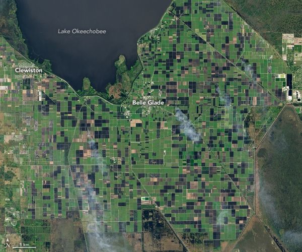
Between October and April each year, NASA satellites routinely observe smoke plumes rising from farmland south of Lake Okeechobee in Florida. Almost all of the plumes appear to come from fires on sugarcane farms. Sugar growers light the hot, fast-moving blazes to burn the leaves and tops off the plant, leaving the sweeter cane material intact—a practice that makes harvesting and transporting sugar cane cheaper. But the smoke has raised health concerns in some nearby communities.
On January 5, 2021, the Operational Land Imager (OLI) on Landsat 8 acquired a natural-color image of multiple sugarcane fires burning near Belle Glade, Florida. The second image (right) is false-color, combining shortwave infrared, near-infrared, and blue light (OLI bands 7, 5, 2). This combination makes it easier to distinguish between fields that are unburned (green), recently burned (black), and recently harvested (brown).
Atmospheric scientists have been studying the frequency of these fires, where the smoke goes, and how much it might affect human health. Research indicates that satellites likely detect only a portion of the sugarcane fires that burn each year. Yet with the help of data from ground-based sensors and atmospheric dispersion models, scientists are finding ways to explore the possible health impacts of the smoke.
Continue reading at NASA Earth Observatory
Image via NASA Earth Observatory


