
On Feb. 7, 2021, the Uttarakhand region of India experienced a humanitarian tragedy when a veritable wall of rock and ice collapsed and formed a debris flow that barreled down the Ronti Gad, Rishiganga and Dhauliganga river valleys.
On Feb. 7, 2021, the Uttarakhand region of India experienced a humanitarian tragedy when a veritable wall of rock and ice collapsed and formed a debris flow that barreled down the Ronti Gad, Rishiganga and Dhauliganga river valleys. The massive slide—caused when a wedge of rock carrying a steep hanging glacier broke off a ridge in the Himalayan mountain range—led to the destruction of two hydropower generating facilities and left over 200 people dead or missing.
A self-organized coalition of 53 scientists came together in the days following the disaster to investigate the cause, scope and impact of the flood and landslide. Their study, which analyzed satellite imagery, seismic records and eyewitness videos to produce computer models of the flow, was published online today in the journal Science.
“People thought it was caused by a glacial lake outburst flood at first, but as scientists looked closer they realized that it was something different,” said Morgan McDonnell, a master’s student in the University of Utah’s Department of Geography and co-author of the paper. “This kind of collaborative effort across many disciplines is going to be essential to understand how regions like these are prone to more extreme hazards as the climate changes.”
Read more at: University of Utah
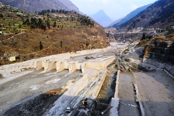
Destroyed Tapovan Vishnugad hydroelectric plant after devastating debris flow of Feb 7, 2021. (Photo Credit: Irfan Rashid, Department of Geoinformatics, University of Kashmir)


