
From above, the Antarctic Ice Sheet might look like a calm, perpetual ice blanket that has covered Antarctica for millions of years. But the ice sheet can be thousands of meters deep at its thickest, and it hides hundreds of meltwater lakes where its base meets the continent’s bedrock.
From above, the Antarctic Ice Sheet might look like a calm, perpetual ice blanket that has covered Antarctica for millions of years. But the ice sheet can be thousands of meters deep at its thickest, and it hides hundreds of meltwater lakes where its base meets the continent’s bedrock. Deep below the surface, some of these lakes fill and drain continuously through a system of waterways that eventually drain into the ocean.
Now, with the most advanced Earth-observing laser instrument NASA has ever flown in space, scientists have improved their maps of these hidden lake systems under the West Antarctic ice sheet—and discovered two more of these active subglacial lakes.
The new study provides critical insight for spotting new subglacial lakes from space, as well as for assessing how this hidden plumbing system influences the speed at which ice slips into the Southern Ocean, adding freshwater that may alter its circulation and ecosystems.
NASA’s Ice, Cloud and land Elevation Satellite 2, or ICESat-2, allowed scientists to precisely map the subglacial lakes. The satellite measures the height of the ice surface, which, despite its enormous thickness, rises or falls as lakes fill or empty under the ice sheet.
Read more at: NASA/Goddard Space Flight Center
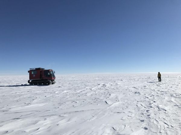
NASA researchers on the surface of the Antarctic Ice Sheet as part of the 88-South Traverse in 2019. The 470-mile expedition in one of the most barren landscapes on Earth provides the best means of assessment of the accuracy of data collected from space by the Ice Cloud and land Elevation Satellite-2 (ICESat-2). (Photo Credit: NASA's Goddard Space Flight Center/Dr. Kelly Brunt)


