
Fires in the country have consumed five times as much land as they do in an average year.
In the first two weeks of August 2021, Greece has endured a series of wildland fires that have charred a large swath of the island of Evia and several areas of the Peloponnese region. The fires followed closely after one of the worst heatwaves in the country since the 1980s, which dried up scarce moisture and left forests primed to burn. Greek Prime Minister Kyriakos Mitsotakis told several news agencies that the fire outbreak has been a “disaster of unprecedented proportions.”
According to data from the European Forest Fire Information System (EFFIS), more than 110,000 hectares (424 square miles) have burned in Greece this year, more than five times the yearly average from 2008 to 2020 (21,000 hectares). EFFIS counted 58 fires (30 hectares or larger) in the country in 2021, already above the yearly average total of 46.
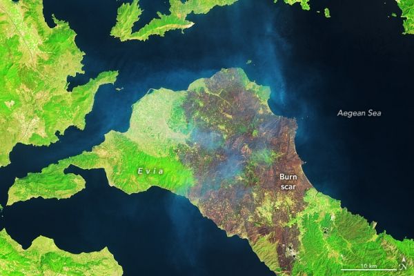
The Operational Land Imager (OLI) on Landsat 8 acquired natural- and false-color views (above) of the north end of Evia on August 10, 2021. The false-color image combines shortwave infrared, near infrared, and red light (OLI bands 6-5-4). In this view, burned vegetation appears dark brown, and greens and yellows indicate a combination of unburned trees and scrub.
Continue reading at NASA Earth Observatory
Image via NASA Earth Observatory


