
The decline of sea ice in the Arctic has made the passage increasingly viable for ships, but it’s still not always smooth sailing.
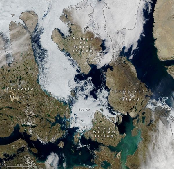
For centuries, explorers have tested the icy waters of the Arctic, looking for sea routes through the cluster of islands north of mainland Canada. Such a route, known as the Northwest Passage, can dramatically shorten the journey between the Pacific and Atlantic Oceans. The decline of sea ice in the Arctic Ocean has made this passage increasingly viable. But as this image shows, it’s still not always smooth sailing.
The Moderate Resolution Imaging Spectroradiometer (MODIS) on NASA’s Aqua satellite acquired this image on August 22, 2021. It shows part of the “southern route”—one of two main routes most feasible for the passage of large ships. Since about 2006, the Northwest Passage has become navigable for a short period late in most summers. So far this year, that hasn’t quite happened.
“The southern route still has ice,” said Walt Meier, a sea ice researcher at the National Snow and Ice Data Center. “But it’s possible a channel could open up in the next couple of weeks before freeze-up starts in earnest.”
Continue reading at NASA Earth Observatory
Image via NASA Earth Observatory


