
The remnants of Hurricane Larry dropped abundant snowfall on Greenland just as the summer melt season was coming to an end.
Hurricanes are known for their destructive wind, rain, and storm surge. Hurricane Larry delivered more than that. On September 12, 2021, the storm’s remnants dropped abundant snowfall on Greenland just as the summer melt season was coming to an end.
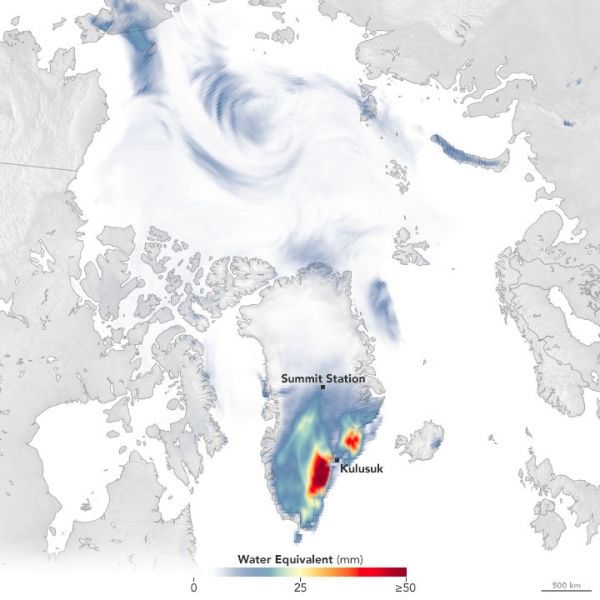
Snowfall amounts on that day are visible in the map above, as represented by the Goddard Earth Observing System (GEOS) model. Snowfall amounts are shown as millimeters of water, as opposed to snow depth, for the 24-hour period. Fifty millimeters of water is equivalent to about 200 millimeters (8 inches) of snow, assuming the snow has a density of 250 kilograms per cubic meter.
Like other weather and climate models, GEOS uses mathematical equations that represent physical processes (like precipitation and cloud processes) to calculate what the atmosphere will do. Actual measurements of physical properties, like temperature, moisture, and winds, are routinely folded into the model to keep the simulation as close to measured reality as possible.
Continue reading at NASA Earth Observatory
Image via NASA Earth Observatory


