
Scientists repeatedly check the weather forecasts as they prepare aircraft for flight and perform last-minute checks on science instruments.
Scientists repeatedly check the weather forecasts as they prepare aircraft for flight and perform last-minute checks on science instruments. There’s a large winter storm rolling in, but that’s exactly what these storm-chasing scientists are hoping for.
The team is tracking storms across the Midwest and Eastern United States in two NASA planes equipped with scientific instruments to help understand the inner workings of winter storms as they form and develop. The team is flying two aircraft to investigate winter storms, one above the storm and one within the clouds. Each is equipped with a suite of scientific instruments to collect data about snow particles and the conditions in which they form. The experiments are part of the second deployment of NASA’s Investigation of Microphysics and Precipitation for Atlantic Coast-Threatening Storms (IMPACTS) mission, which began in January and is planned to wrap up at the end of February.
This data will help the team relate properties of the snow particles and their environment to large-scale processes – such as the structure of clouds and precipitation patterns – that can be seen with remote sensing instruments on aircraft and satellites. Ultimately, what the IMPACTS team learns about snowstorms will improve meteorological models and our ability to use satellite data to predict how much snow will fall and where.thor Eric Post, director of the UC Davis Polar Forum and a professor in the UC Davis Department of Wildlife, Fish and Conservation Biology.
Read more at: Nasa/Goddard Space Flight Center
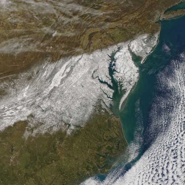
On Jan. 4, 2022, the MODIS instrument aboard NASA’s Terra satellite captured this image of snowfall after a large storm dumped wet, heavy snow across the Mid-Atlantic region of the United States. Some areas accumulated over 14 inches, shutting down businesses, schools, and interstate highways. (Photo Credit: NASA)


