
As ice sheets began melting at the end of the last ice age, a series of cataclysmic floods called the Missoula megafloods scoured the landscape of eastern Washington, carving long, deep channels and towering cliffs through an area now known as the Channeled Scablands.
As ice sheets began melting at the end of the last ice age, a series of cataclysmic floods called the Missoula megafloods scoured the landscape of eastern Washington, carving long, deep channels and towering cliffs through an area now known as the Channeled Scablands. They were among the largest known floods in Earth’s history, and geologists struggling to reconstruct them have now identified a crucial factor governing their flows.
In a study published February 14 in Proceedings of the National Academy of Sciences, researchers showed how the changing weight of the ice sheets would have caused the entire landscape to tilt, changing the course of the megafloods.
“People have been looking at high water marks and trying to reconstruct the size of these floods, but all of the estimates are based on looking at the present-day topography,” said lead author Tamara Pico, assistant professor of Earth and planetary sciences at UC Santa Cruz. “This paper shows that the ice age topography would have been different over broad scales due to the deformation of Earth’s crust by the weight of the ice sheets.”
During the height of the last ice age, vast ice sheets covered much of North America. They began to melt after about 20,000 years ago, and the Missoula megafloods occurred between 18,000 and 15,500 years ago. Pico’s team studied how the changing weight of the ice sheets during this period would have tilted the topography of eastern Washington, changing how much water would flow into different channels during the floods.
Read more at: University of California - Santa Cruz
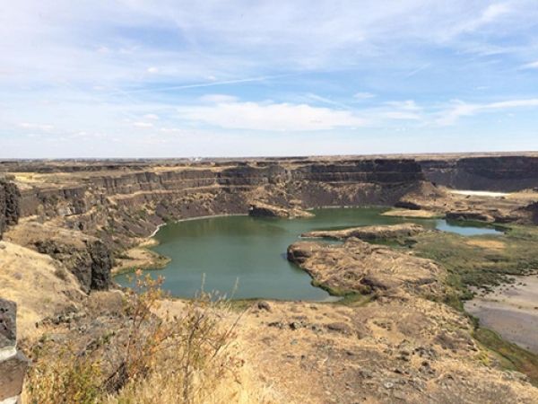
Enormous volumes of floodwater from the Missoula megafloods once poured over Dry Falls, which stretches 3.5 miles wide and drops 400 feet to a plunge pool now fed by groundwater. (Photo Credit: Tamara Pico)


