
Cyclone Emnati marks the fifth time in six weeks that heavy rain and destructive wind are blowing in from the Indian Ocean.
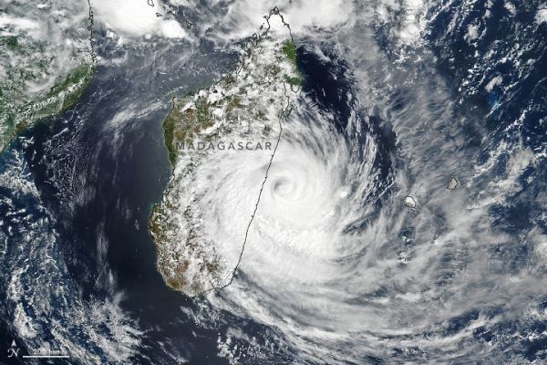
For the fifth time in six weeks, heavy rain and destructive wind are blowing into Madagascar from the Indian Ocean. Tropical Cyclone Emnati is expected to make landfall along the eastern coast between the cities of Mananjary and Manakara late on February 22, 2022.
In January 2022, a series of torrential tropical rainstorms was followed by tropical depression and storm Ana. February brought Cyclones Batsirai and Dumako. Now Cyclone Emnati is headed for landfall in the same region where Batsirai flooded and displaced thousands of people.
The Visible Infrared Imaging Radiometer Suite (VIIRS) on the NOAA-NASA Suomi NPP satellite acquired this natural-color image after midday on February 22, 2022. (Use the slider to overlay the paths of the other recent storms.) Around that time, Emnati had sustained winds of 140 kilometers (85 miles) per hour. Winds peaked at 200 kilometers (125 miles) per hour on February 20.
Continue reading at NASA Earth Observatory
Image via NASA Earth Observatory


