
Despite an overall trend of Arctic ice loss, the Bering Sea saw an expansion of sea ice due to a short-lived atmospheric-pressure pattern.
In 2022, the floating ice cover in the Bering Sea reached its greatest extent for early to mid-February since 2013. By February 13, the sea ice had reached St. Paul in the Pribilof Islands for the first time since March 2020. The ice growth is an outlier amid a long-term decline.
In the Arctic, where annual average temperatures have increased more than three times as fast as the global average, the sea ice extent is declining. This is true especially in summer, but also year-round, in nearly every region—except the Bering Sea, said Walt Meier, a sea ice researcher at the National Snow and Ice Data Center (NSIDC). "The one exception has been the Bering Sea during late winter and early spring (February to April), where there is an increasing trend," said Meier. The reasons for this are not totally understood, but may relate to multidecadal variability in the northern Pacific Ocean, he added.
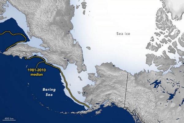
The map above shows the extent sea ice in the Bering Sea on February 16, 2022, when it covered more than 846,000 square kilometers (327,000 square miles), exceeding the 1981–2010 mean. (Ice extent is the area with at least 15 percent ice cover, the minimum at which space-based measurements give a reliable measurement.)
Continue reading at NASA Earth Observatory
Image via NASA Earth Observatory


