
In the midst of a megadrought, scientists are working to improve snowpack measurements used to forecast water supplies.
As another winter ends with the U.S. West still in the grip of the worst megadrought in 1,200 years, scientists and water managers are looking at the state of the snowpack. Mountain snowpack is a natural reservoir: As it melts out over the course of the spring and summer, it provides a steady supply of water for millions of people who rely upon it for agriculture, industry, and municipal and residential use.
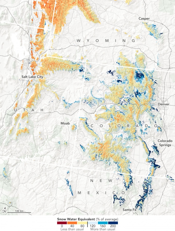
To forecast water supplies for the coming year, hydrologists and water managers rely on measurements of snowpack, particularly the snow water equivalent (SWE), a measure of how much liquid water is stored within snow. In the western U.S., snowpacks usually peak around April 1. Assessment of the snowpack on this date has traditionally been used to help predict streamflows, reservoir storage levels, and potential wildfire conditions for the rest of the year.
This year, with drought-related moisture deficits in the soil and atmosphere, researchers are seeing widespread and severe low-snow and low-runoff conditions across the West, said Benjamin Hatchett, a hydroclimatologist at the Desert Research Institute who studies snow droughts. “Usually, some regions will be bad, some will be doing okay, and others will be doing great,” Hatchett noted. “But when everywhere [in the West] is in this low-snow condition, it’s pretty concerning.”
Continue reading at NASA Earth Observatory
Image via NASA Earth Observatory


