
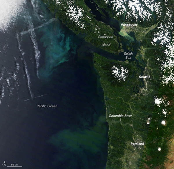
In early summer 2022, a high-pressure system brought warm, clear weather to the Pacific Northwest.
In early summer 2022, a high-pressure system brought warm, clear weather to the Pacific Northwest. The unusually cloud-free skies on June 26 allowed satellites to observe a colorful phenomenon taking shape in the ocean nearby: the proliferation of countless phytoplankton.
Phytoplankton blooms are common in the northeast Pacific Ocean during summer as offshore winds push surface waters away from the coast. This causes cooler, nutrient-rich waters to well up from the depths and fuel the growth of phytoplankton. Research has shown that a significant amount of nutrients are also supplied by the circulation and upwelling that occurs in the Salish Sea, boosting phytoplankton productivity along the continental shelf off Vancouver Island and Washington.
It is less common for skies to be clear enough for satellites to acquire a view of such blooms. But on June 26, the high-pressure weather system and associated sinking air helped prevent clouds from forming over land and offshore. On that morning, the Moderate Resolution Imaging Spectroradiometer (MODIS) on NASA’s Terra satellite acquired this natural-color image.
Read more at: NASA Earth Observatory
Unusually cloud-free skies allowed satellites to observe colorful phenomenon taking shape in the region’s coastal waters. (Photo Credit: NASA Earth Observatory)


