
More than 180 wildland fires burned across Canada on June 1, 2025, continuing what has been an active fire year so far.
More than 180 wildland fires burned across Canada on June 1, 2025, continuing what has been an active fire year so far. Some of the fires produced plumes so thick and widespread they were easily visible from a vantage point in space well beyond that of the Moon.
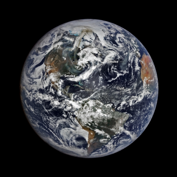
NASA’s EPIC (Earth Polychromatic Imaging Camera) on NOAA’s DSCOVR satellite acquired this image on May 31, 2025. The instrument is positioned 1.5 million kilometers (1 million miles) from Earth’s surface, which is about four times farther than the orbit of the Moon. For comparison, most polar orbiting satellites that observe Earth orbit at an altitude of less than 1,000 kilometers. From its distant position, EPIC captures a color image of the entire sunlit side of Earth at least once every two hours.
The EPIC wide view shows smoke from fires burning primarily in the Canadian provinces of Saskatchewan and Manitoba. The plumes extend to the north-northeast across Nunavut toward the coast of Greenland and southward across the United States. Another patch of smoke is visible over the Atlantic Ocean near Europe. Note that the hazy air west of Africa is not smoke but dust that has blown westward from the Sahara Desert.
Read More: NASA Earth Observatory
Photo Credit: Wanmei Liang/NASA Earth Observatory


