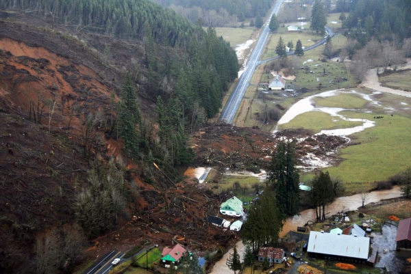
Landslides cause an estimated $3-6 billion in damage and multiple fatalities annually in the United States.
Landslides cause an estimated $3-6 billion in damage and multiple fatalities annually in the United States. Those numbers could easily increase as housing needs spur development in landslide-prone areas, and as climate change increases the severity and frequency of heavy rains, which are often a trigger. Despite the threat, there has never been a systematic, nationwide accounting of who is most at risk from landslides.
The new Landslide Exposure Database is the first resource to map building-level landslide risk for the entire U.S. The database, developed by University of Washington researchers, rates 128 million buildings by landslide susceptibility, and uses socioeconomic data to assess residents’ vulnerability to the dangers and disruptions caused by landslides.
According to the analysis, roughly 6.5 million people live in landslide-prone regions; most of those people are concentrated in Appalachia and along the West Coast. Urban residents of landslide-prone properties tended to be more affluent and resilient, whereas rural residents in at-risk areas tended to be less resourced and more vulnerable to the impacts of a landslide.
Read More at: University of Washington
A landslide in 2007 damaged Washington’s State Route 6 and several structures near the town of Pe Ell. New research from the University of Washington maps the communities most at risk from landslides nationwide; the database counts roughly 6.5 million vulnerable residents across the country. (Photo Credit: Washington State Department of Transportation)