
As Hurricane Dorian approaches Florida, U.S. Geological Survey field crews are working along a 280-mile stretch of the state’s Atlantic coastline, installing instruments that will track the hurricane’s effects as it comes ashore.
As Hurricane Dorian approaches Florida, U.S. Geological Survey field crews are working along a 280-mile stretch of the state’s Atlantic coastline, installing instruments that will track the hurricane’s effects as it comes ashore.
USGS scientists are also installing the instruments, which gather precise storm tide information, along the Georgia coast, and preparing for installations on Florida’s Gulf coast if the storm’s path warrants it.
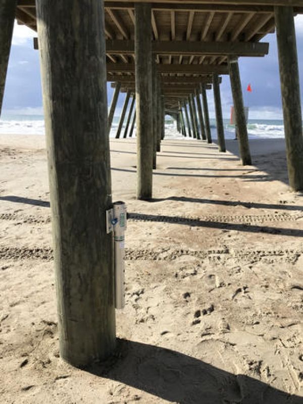
Image shows a USGS storm tide sensor attached to a pier
On Thursday and Friday, Aug. 29 and 30, the USGS is deploying 18 field scientists to install scientific instruments at more than 60 locations along the Florida coast between Jacksonville and West Palm Beach. Some instruments are designed to measure the height and intensity of the storm surge if Dorian affects Florida’s Atlantic coast, as the National Hurricane Center forecasts it will. Others will monitor water levels on inland water bodies; the field crews will gather data from them immediately after the storm has passed.
In Georgia, field scientists will install 62 measuring devices the length of the state’s low-lying coastline, because slow-moving Hurricane Dorian may cause higher-than-normal ocean waves well to the north of the storm. Forecasters do not expect the hurricane to make landfall in Georgia.
Continue reading at USGS.
Image via Jessica Cain, USGS.


