
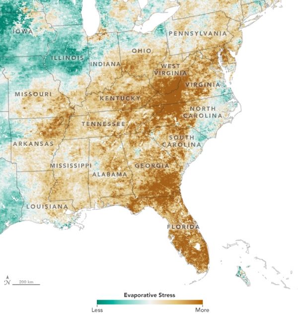
Maps show Evaporative Stress Index (ESI) data indicating rapid onset of drough conditions throughout southeast United States.
When you hear the word “drought”, lack of rain probably comes to mind. But it is not only lack of rain that has put farmers in the U.S. Southeast in the grips of a damaging drought this fall.
Bouts of unusually warm temperatures, lots of sun, low humidity, and windy conditions can also come together to dry out soil surprisingly quickly, explained Christopher Hain, a scientist at NASA’s Marshall Space Flight Center in northern Alabama. So quickly, in fact, meteorologists have coined a term—flash drought—to describe these fast-moving events.
A stubborn ridge of high-pressure air hung over the Southeast for several weeks in September, bringing record-breaking temperatures, dry air, and very little rain. “We had a wet spring in the Southeast, so we went from no drought to severe drought within about four weeks,” said Hain. “I’m hearing about farmers losing cotton, hay, and other forage crops. We are even seeing trees browning in certain areas.”
Other categories of drought can take much longer to develop. For instance, hydrological drought—like the one that made news in California in recent years—are defined by drops in groundwater levels, reservoirs, and stream flow that tend to span several months or years.
Continue reading at NASA Earth Observatory
Image via NASA Earth Observatory


