
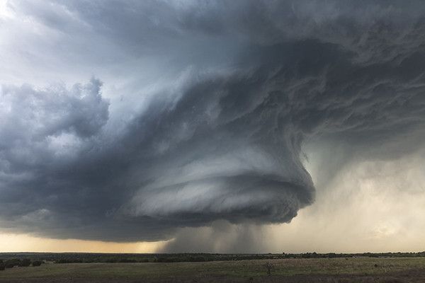
Penn State researchers found in a new study that combining data from new geostationary satellites and Doppler radar provided the best forecasts of a supercell thunderstorms event in 2017 in the Midwest.
Every minute counts when it comes to predicting severe weather. Combing data from cutting-edge geostationary satellites and traditional weather radar created a path toward earlier, more accurate warnings, according to Penn State researchers who studied supercell thuderstorms in the Midwest.
“We know satellites have an advantage in producing forecasts earlier, and radar has more confidence in where clouds should be and where thunderstorms will be moving,” said Yunji Zhang, assistant research professor in meteorology and atmospheric sciences at Penn State. “The question was whether these two types of observations would complement each other if combined together. We found, for at least one severe weather event, assimilating satellite and radar simultaneously leads to the best forecasts.”
Data assimilation is a statistical method used to paint the most accurate possible picture of current weather conditions, important because even small changes in the atmosphere can lead to large discrepancies in forecasts over time.
The scientists assimilated satellite and radar data separately and simultaneously to see which combination could best recreate conditions during a large storm system that struck Wyoming and Nebraska in 2017. The best results came from combining infrared brightness temperature observations from satellites, and radial wind velocity observations from radar, the scientists reported in the American Meteorological Society journal Monthly Weather Review.
Continue reading at Pennsylvania State University
Image via Pennsylvania State University


