
The Jason-CS/Sentinel-6 mission that will track sea level rise, one of the clearest signs of global warming, for the next 10 years.
Earth's climate is changing, and the study of oceans is vital to understanding the effects of those changes on our future. For the first time, U.S and European agencies are preparing to launch a 10-year satellite mission to continue to study the clearest sign of global warming — rising sea levels. The Sentinel-6/Jason-CS mission (short for Jason-Continuity of Service), will be the longest-running mission dedicated to answering the question: How much will Earth's oceans rise by 2030?
By 2030, Sentinel-6/Jason-CS will add to nearly 40 years of sea level records, providing us with the clearest, most sensitive measure of how humans are changing the planet and its climate.
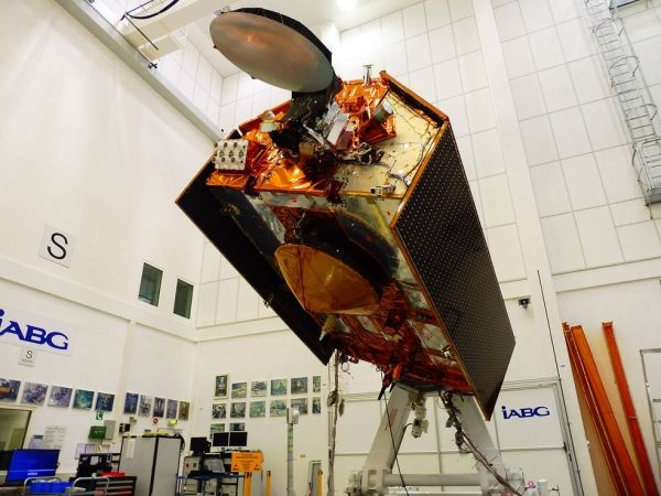
The mission consists of two identical satellites, Sentinel-6A and Sentinel-6B, launching five years apart. The Sentinel-6A spacecraft was on display for the media on Nov. 15 for a last look in its clean room in Germany's IABG space test center. The satellite is being prepared for a scheduled launch in November 2020 from Vandenberg Air Force Base in California on a SpaceX Falcon 9 rocket.
Sentinel-6/Jason-CS follows in the footsteps of four other joint U.S.-European satellite missions — TOPEX/Poseidon and Jason-1, Ocean Surface Topography/Jason-2, and Jason-3 — that have measured sea level rise over the past three decades. The data gathered by those missions have shown that Earth's oceans are rising by an average of 0.1 inches (3 millimeters) per year.
Sentinel-6/Jason-CS will continue that work, studying not just sea level change but also changes in ocean circulation, climate variability such as El Niño and La Niña, and weather patterns, including hurricanes and storms.
Continue reading at NASA
Image via NASA


