
Among the byproducts of the pandemic and social distancing is a drop in forest management fires on federal lands.
Fire has long been used as a tool to manage pine forests in the U.S. Southeast. In a normal year, virtually all of the springtime fire activity in the region (as detected by NASA satellites) is associated with prescribed fires by forest managers.
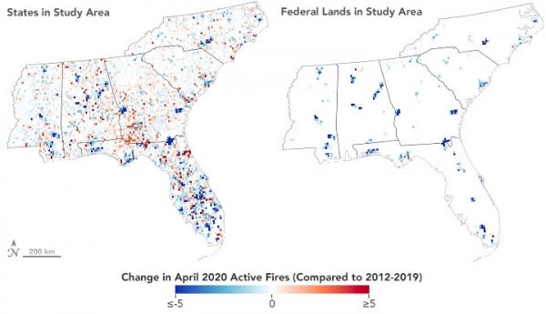
But spring 2020 has been anything but normal. With a novel strain of coronavirus spreading throughout the United States, many prescribed burning programs have been disrupted by public health measures aimed at slowing the spread of the virus and minimizing smoke exposure. The U.S. Forest Service temporarily suspended all of its prescribed burns on federal lands in the Southeast in March, and state agencies in Mississippi, South Carolina, and North Carolina also issued spring burning bans.
As shown by the chart below, the number of active fires detected in the Southeast by the Visible Infrared Imaging Radiometer Suite (VIIRS) on the Suomi NPP satellite fell 42 percent below normal between January 1, 2020, and May 9, 2020, as compared to the 2012-2020 average for the same period.
Continue reading at NASA Earth Observatory
Image via NASA Earth Observatory


