
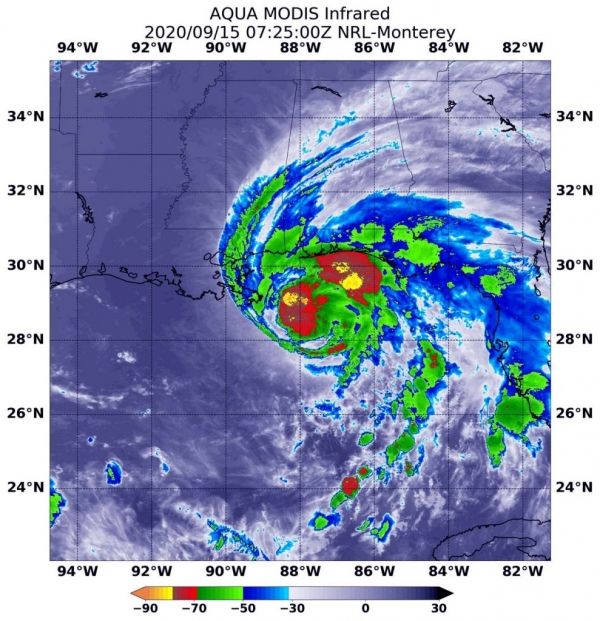
NASA’s Aqua satellite analyzed the cloud top temperatures and water vapor content in Hurricane Sally as it crawls toward landfall, and found the potential for large amounts of rainfall, which, coupled with slow movement, can lead to catastrophic flooding.
Two instruments provided three views of Sally’s temperatures and water vapor that revealed the soaking capability of the slow-moving hurricane.
At 8 a.m. EDT on Sept. 15, NOAA’s National Hurricane Center (NHC) cautioned, “Historic flooding is possible from Sally with extreme life-threatening flash flooding likely through Wednesday [Sept. 16] along portions of the northern Gulf Coast.” Forecasters are using NASA’s infrared and water vapor data to analyze the rainfall potential from Sally.
NHC issued a Storm Surge Warning for the mouth of the Mississippi River to the Okaloosa/Walton County Line, Florida and for Mobile Bay. A Hurricane Warning is in effect for east of the Mouth of the Pearl River to Navarre, Florida. A Tropical Storm Warning is in effect for east of Navarre, Florida to Indian Pass, Florida and from the mouth of the Pearl River westward to Grand Isle, Louisiana, including Lake Pontchartrain and Lake Maurepas and metropolitan New Orleans.
Continue reading at NASA Goddard Space Flight Center
Image via NASA Goddard Space Flight Center


