
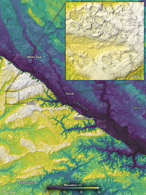
There are hundreds of thousands of oval depressions dotting the Atlantic coastal plain—relicts of a cooler, drier, windier time.
During the last ice age, the Atlantic coastal plain of the southeastern U.S. was a cold, dry, and windy place. With patches of permafrost stretching as far south as Georgia, the seasonal freezing and thawing of sandy soils left landscapes littered with thermokarst lakes and scattered sand dunes and ridges—much like those now found in parts of Alaska and the Arctic.
If you know where to look in the Carolinas, Georgia, Virginia, Maryland, and Delaware, you can still find abundant relicts from this cooler period. At ground level, clusters of low-relief oval depressions called Carolina bays can look as ordinary as a lake, bog, or farm field. Yet from above—from an airplane or satellite—the distinctive features stand out.
The image at the top of the page shows a collection of Carolina bays near Bladen Lakes State Forest in North Carolina. The natural-color image was acquired by the Operational Land Imager (OLI) on Landsat 8; the data were then draped over a digital elevation model to emphasize the terrain.
Continue reading at NASA Earth Observatory
Image via NASA Earth Observatory


