
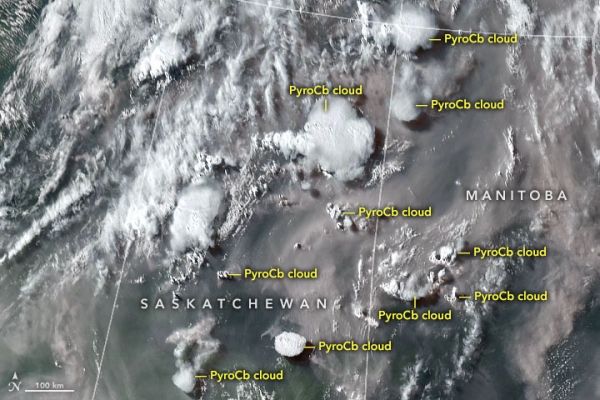
For decades, scientists have been tracking extreme thunderstorms created by wildfires. However, the ferocity of the storms that have popped up in Canada in 2021 has surprised them.
In 2000, atmospheric scientists from the U.S. Naval Research Laboratory (NRL) first reported that smoke plumes from intense wildfires could spawn towering thunderstorms that channeled smoke as high or higher than the cruising altitude of jets. These pyrocumulonimbus, or pyroCb, events wowed scientists at the time. Prior to that discovery, only explosive volcanic eruptions and extreme thunderstorms were thought to be capable of lofting material so high.
Though the workings of these smoke-infused storm clouds have come into clearer focus, their increasingly extreme behavior in recent years has surprised and worried some scientists who track them. The latest encounters with these fire-breathing smoke clouds came in North America in June and July 2021 during an unusually warm fire season that arrived early in Canadian and U.S. forests.
Michael Fromm and David Peterson of NRL and a team of colleagues from NASA and several other institutions have used the Advanced Baseline Imager (ABI) on the NOAA-NASA GOES weather satellites, as well as sensors on other satellites, to identify 61 pyroCbs in North America this year as of July 29, 2021, about the halfway point of the fire season.
Continue reading at NASA Earth Observatory
Image via NASA Earth Observatory


