
A team of researchers led by Brian Yellen, research professor of earth, geographic, and climate sciences at the University of Massachusetts Amherst, recently announced in the Journal of Geophysical Research: Earth Surface that salt marshes, critical habitats threatened by rapid sea-level rise, may in fact thrive despite higher water levels.
A team of researchers led by Brian Yellen, research professor of earth, geographic, and climate sciences at the University of Massachusetts Amherst, recently announced in the Journal of Geophysical Research: Earth Surface that salt marshes, critical habitats threatened by rapid sea-level rise, may in fact thrive despite higher water levels. The key factor that determines whether salt marshes collapse or flourish involves not water, but sediment.
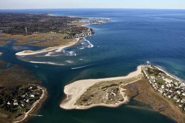
To reach this conclusion, Yellen and his colleagues looked all the way back to 1898, when the Portland Gale, a vicious Nor’easter, battered the Massachusetts coast with hurricane-force winds, buckets of rain, and a ten-foot storm surge, which remade the North-South Rivers Estuary, in Scituate, just south of Boston.
Before 1898, the North River took a hard south-eastern turn on its way to the Atlantic Ocean, flowing behind a barrier beach for about three-and-a-half miles, until it joined up with the South River at today’s popular Rexhame Beach, where both rivers finally exited to the sea. But when the Portland Gale hit, in late November, it blasted a hole through the northern end of the barrier beach, shortening the North River’s journey by three-and-a-half miles. High tides in the newly shortened tidal river immediately rose by at least a foot—the kind of sea-level rise that scientists say the world may see by the end of the century.
Read more at: University of Massachusetts - Amherst
The meeting of the North and South Rivers (at left) and their shared inlet to the Atlantic Ocean, which formed in 1898. (Photo Credit: Bill Richardson)


