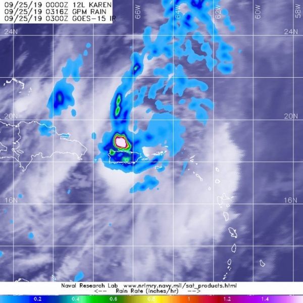
Tropical Storm Karen has crossed over Puerto Rico and into the western Atlantic Ocean.

Tropical Storm Karen has crossed over Puerto Rico and into the western Atlantic Ocean.

In a new study, researchers found that unless steps are taken to mitigate climate change, up to 60 percent of current wheat-growing areas worldwide could see simultaneous, severe and prolonged droughts by the end of the century.

Quantum computing has the potential to revolutionize technology, medicine, and science by providing faster and more efficient processors, sensors, and communication devices.
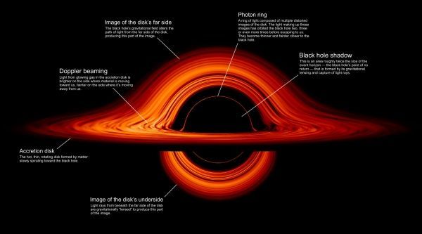
This new visualization of a black hole illustrates how its gravity distorts our view, warping its surroundings as if seen in a carnival mirror.

Humans have never before lived with the high carbon dioxide atmospheric conditions that have become the norm on Earth in the last 60 years, according to a new study that includes a Texas A&M University researcher.
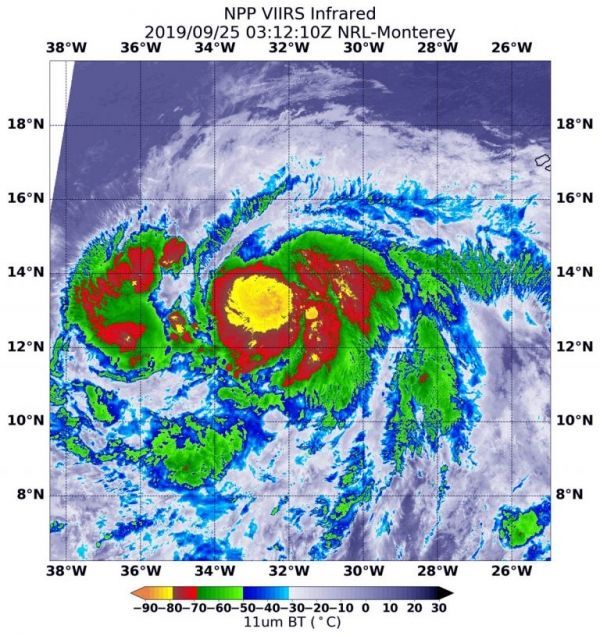
Dropping cloud top temperatures from NASA-NOAA’s Suomi NPP satellite indicated Hurricane Lorenzo was getting stronger in the North Atlantic Ocean.


