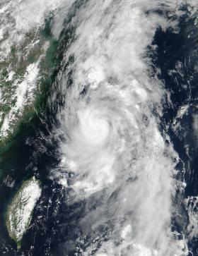
Two NASA satellites provided a look at the Northwestern Pacific Ocean's latest tropical storm from outside and inside. NASA-NOAA's Suomi NPP satellite provided an outside look at Nanmadol when it's maximum sustained winds peaked, and the GPM Core satellite provided an inside look at the rainfall within the storm.
Before consolidating into the fifth depression of the Northwestern Pacific Ocean's hurricane season, Nanmadol was a low pressure system designated System 99W. That low pressure area developed and was renamed Nanmadol on July 2.